Southern California Outdoors & Recovery
Hiking Los Angeles in November: Closures, Fire Weather and the Early Sunset
Before the trailhead, check who manages the land, whether the route is open, what fire weather is doing and how much daylight you actually have.
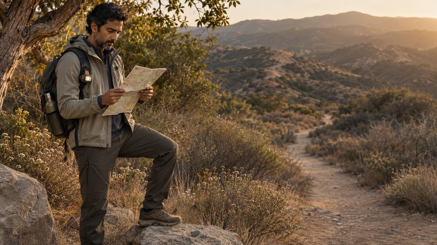
The trail outfit can survive a wrong turn. You may not enjoy the sequel.
November hiking in Los Angeles looks simple from the parking lot: cooler air, cleaner light and enough wardrobe potential to justify the overshirt. The complicated part is invisible. A route can cross county, state, federal or conservancy land, and each manager may post a different closure, fire-weather rule or operating schedule. So the first move is not stretching. It is verification. Check the official page for the exact trail and trailhead on the morning you leave, then check again if the forecast changes. A saved map, old review or social post can describe a route that is not open today.
Today’s Red Flag Warning is a planning signal—not a scenic filter
As of the morning of Saturday, November 7, the National Weather Service Los Angeles/Oxnard office had a Red Flag Warning in effect for portions of Los Angeles and Ventura counties through 6 p.m., with a Wind Advisory for some mountain areas through 2 p.m. The warning described dry, windy conditions that could support rapid fire growth. This is a date-stamped status, not a forecast for the rest of November. Before leaving, open the current NWS forecast and the official page for the park or trail. California State Parks now uses a coordinated Santa Monica Mountains closure protocol during Red Flag Warnings; specific parks may close depending on the forecast and local conditions. Do not treat an open gate yesterday as permission today, and never go around a barrier.
Ask one question before searching the trail name: who manages it?
A generic map app may show one continuous green line. The agencies may see several jurisdictions. Los Angeles County maintains its own trail alerts. California State Parks posts park-specific notices. National Park Service, U.S. Forest Service and local conservancy pages may control adjoining segments or access points. Use the official page named on the trailhead sign or agency map. Confirm the route, trailhead, parking area and connector—not just the destination. Screenshot the current map and closure notice in case service disappears, but remember that a screenshot is a record of what you checked, not a lifetime permit.
Eaton Canyon is still a closure story
Los Angeles County’s Eaton Fire closure notice says Eaton Canyon Natural Area and a group of nearby county trails remain closed through December 31, 2027 because of fire damage and recovery work. The same notice says several Forest Service-side trails—including Sunset Ridge, Dawn Mine, Tom Sloane and Bear Canyon—have reopened. That split is exactly why “Is Eaton Canyon open?” needs a precise answer. A reopened forest segment does not reopen a closed county trail or access route. Read the county alert, follow posted boundaries and choose a fully open alternative rather than assembling a route from fragments.
Topanga is open—with restrictions that still matter
California State Parks lists Topanga State Park as open with restrictions. Its current page identifies continuing closures that include Rogers Road, Bent Arrow, Josepho Spur, Rustic Canyon, the Lower Topanga day-use area and trails in Temescal Canyon. Other restrictions can be added during fire weather. Check the park page on the day of the hike. If your planned loop uses a closed connector, the honest answer is not to improvise deeper into unfamiliar terrain. Pick a route whose entire access and exit are confirmed open.
November gives you less daylight than your group chat thinks
Los Angeles County says its general trail hours are sunrise to sunset. California State Parks also warns that trails close at sunset. The National Park Service recommends setting a turnaround time and remembering that the return can take longer than expected because of elevation, fatigue or navigation. Build the day backward from sunset, not forward from brunch. Carry a working headlamp even for a daytime hike, keep it accessible and choose a turnaround time that protects a margin for the return. A phone flashlight is useful backup; it is not a complete plan for a low battery, a dropped phone or two people who separate.
The Ten Essentials are not a personality test
NPS recommends the Ten Essentials: navigation, sun protection, insulation, illumination, first-aid supplies, fire, repair tools, nutrition, hydration and emergency shelter. California State Parks adds the practical basics: tell someone your route and return time, bring a map, stay on the designated trail and carry a charged phone with backup power. Adapt the kit to the route, weather and group without turning the daypack into theater. Water, food, a layer, sun protection, a headlamp, navigation and a modest first-aid kit have jobs. Share the route with someone who is not on the hike and tell them what to do if you miss the check-in.
| Moment | Check | Do not assume |
|---|---|---|
| Before leaving | Official trail status, current NWS alert, sunset, parking and the complete route | That an old review or map-app line proves access is open |
| At the trailhead | Posted closures, wind, group condition, water and turnaround time | That arriving means you must continue |
| On the trail | Stay together, stay on route and turn around on schedule | That the return will take the same time as the way out |
| After the hike | Eat, hydrate, rest and describe any symptoms honestly | That every pain is a knot for massage or stretching |
| Severe or concerning symptoms | Stop the wellness plan and seek the appropriate level of medical care | That a directory, article or trainer can diagnose the problem |
Conditions and closures can change quickly. The official land manager and current weather service—not this table—control today’s decision.
Choose the hike for the body you brought—not the body in the saved post
Mileage alone does not describe a hike. Elevation gain, footing, heat, wind, exposure and the pace of the group can change the demand. NPS advises hikers to know their limits, stay together and choose activities appropriate for the group. A fitness professional can help build strength, balance or conditioning over time. They cannot certify that a trail is safe today, replace the land manager or diagnose a new injury. Ask what the training includes, how progress is adjusted and whether the professional stays within their credentials. The useful plan should make the next outing more prepared—not more performative.
Recovery begins with an honest description of what happened
After an ordinary hike, food, water, a shower, gentle movement and sleep may be enough. If you want massage, assisted stretching or another recovery service, describe the route, effort, any fall or twist, where you feel discomfort and whether symptoms are improving. A provider can decide whether the requested service fits their scope; they should not promise to repair an injury they have not evaluated. Do not use a recovery booking to delay appropriate care for severe pain, inability to bear weight, major swelling, a head injury, chest symptoms, confusion, fainting or another urgent concern. And after unusually hard exertion, severe muscle pain or weakness with dark urine deserves prompt medical attention—not a deeper-pressure appointment.
The NOCTI verdict: the elegant plan is the one with an exit
For Los Angeles hiking in November, build a four-check habit: official closure page, current weather alert, realistic turnaround time and a route shared with someone off-trail. Then pack the light, water and layer you hope not to need. The hills will still be photogenic after you make the cautious decision. The best trail story is the one that ends where you planned, with enough daylight left to decide where dinner is.
SourcesNational Weather Service Los Angeles/Oxnard: current Los Angeles County forecasts, National Weather Service: Red Flag Warning meaning and wildfire-weather safety +7 more
- National Weather Service Los Angeles/Oxnard: current Los Angeles County forecasts, watches and warnings ↗
- National Weather Service: Red Flag Warning meaning and wildfire-weather safety ↗
- Los Angeles County Trails: current trail alerts ↗
- Los Angeles County Trails: Eaton Fire and Palisades Fire closures ↗
- Los Angeles County Trails: hours, access and trail-use FAQ ↗
- California State Parks: Topanga State Park current conditions and restrictions ↗
- California State Parks: coordinated Red Flag Warning closure protocol for the Santa Monica Mountains ↗
- National Park Service: hiking safety, turnaround planning and the Ten Essentials ↗
- California State Parks: trail safety and trip-planning guidance ↗
Train for the trail. Never outsource the trail decision.
Use NOCTI to compare independent fitness, movement and recovery profiles. Confirm the professional’s actual service, setting, price and scope directly—and check the land manager and forecast yourself before every hike.
Explore Fitness & Movement